High Line Area Zoning Districts
|
Zoning Types
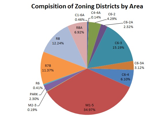
As a key tool in fostering economic growth and preserving local resources, zoning regulations are capable of changing the overall social dynamic of a neighborhood, both aesthetically and culturally. Thus, changes in zoning designations often indicate gentrification within a neighborhood. With these zoning maps, one can explore how the area evolved from a working class, manufacturing hub into a chic living space for affluent professionals. To determine which zoning type currently dominates the study area, a zoning geodatabase file was downloaded from the New York City Planning Website and uploaded in Esri ArcMap (see Zonning Classification Map). After clipping the zoning file to the extent of the study area, the area of each zoning polygon was determined . Here, we can see that manufacturing areas still comprise over a third of the of the total area. |
Geodtabase information provided by the NYC Department of Planning (http://www.nyc.gov/html/dcp/)
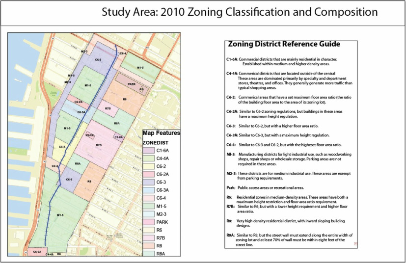
Comparing the Field Data with Historical Zoning Records
For the most part, the field data corresponded well with the most current zoning maps (shown below). After comparing the field data and current zoning maps to previous zoning maps, it is apparent that the neighborhoods in the study area were rezoned to accommodate more residential and commercial use. Dr. Stacey A. Sutton, Columbia professor and author of Urban Revitalization in the United States: Private, Public and Community-Led Projects, comments on the zoning evolution of the area, stating: "With only four meatpacking businesses left and the new 337-room Standard Hotel [now Complete] to open early in 2009, the transformation of the Meatpacking District from a formerly remote warehouse district is close to complete" (Sutton 66). Indeed, the neighborhoods surrounding the High Line Park are rife with fashionable shopping centers, each looking to benefit from the economics of agglomeration. Overtime, the maps reveal a slowly eroding manufacturing base in the area.
For the most part, the field data corresponded well with the most current zoning maps (shown below). After comparing the field data and current zoning maps to previous zoning maps, it is apparent that the neighborhoods in the study area were rezoned to accommodate more residential and commercial use. Dr. Stacey A. Sutton, Columbia professor and author of Urban Revitalization in the United States: Private, Public and Community-Led Projects, comments on the zoning evolution of the area, stating: "With only four meatpacking businesses left and the new 337-room Standard Hotel [now Complete] to open early in 2009, the transformation of the Meatpacking District from a formerly remote warehouse district is close to complete" (Sutton 66). Indeed, the neighborhoods surrounding the High Line Park are rife with fashionable shopping centers, each looking to benefit from the economics of agglomeration. Overtime, the maps reveal a slowly eroding manufacturing base in the area.
Changes in High Line Area Zoning Districts
1961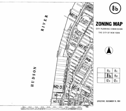
|
1981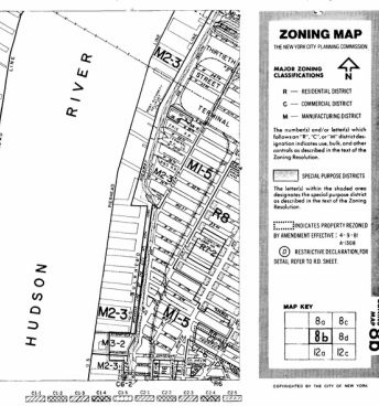
|
1999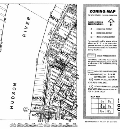
|
2005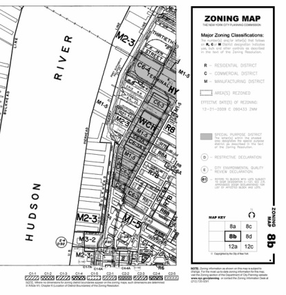
|
Cover Photo by Friends of the High Line Historic Maps Provided by the NYC Planning Department (http://www.nyc.gov/html/dcp/)
